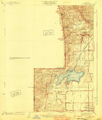
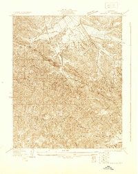
1940 Map of Chatsworth
USGS Topo · Published 1940About this map
Iverson Ranch and the Garden of the Gods stand out as prominent landmarks in this 1940 survey of the northwestern San Fernando Valley. At this time, the landscape is a transition between the rugged Santa Susana Mountains and the developing agricultural and residential tracts of the Ex Mission San Fernando. The Chatsworth Reservoir dominates the central portion of the map, serving as a critical water infrastructure point for the region.
Find a feature on this map
54 named features on this map. Tap any name to fly to it.
Don’t see what you’re looking for? This feature index may not catch every label — zoom into the map to look around manually.
Map Details
Editions of this 1940 Chatsworth Map
This is the sole edition of this map. No revisions or reprints were ever made.
Other maps of this area

1903 · Calabasas
USGS Topo · 1:62,500

1903 · Camulos
USGS Topo · 1:125,000

1903 · Santa Susana
USGS Topo · 1:62,500

1925 · Chatsworth
USGS Topo · 1:24,000

1927 · Chatsworth
USGS Topo · 1:24,000
1928 · Zelzah
USGS Topo · 1:24,000

1928 · Dry Canyon
USGS Topo · 1:24,000
1928 · Reseda
USGS Topo · 1:24,000
1929 · Zelzah
USGS Topo · 1:24,000
1929 · Newhall
USGS Topo · 1:24,000