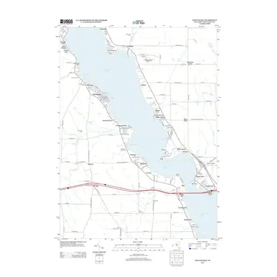
2013 Map of Chautauqua
USGS Topo · Published 2013About this map
Chautauqua Lake dominates the center of this New York landscape, serving as a focal point for the numerous lakeside communities that line its eastern and western shores. The western side is anchored by the historic Chautauqua Institution and the village of Chautauqua, surrounded by smaller residential clusters like Wahmeda and Orchard Terrace. On the opposite shore, the map details the narrow crossing at Bemus Point, where the lake constricts between Toms Point and Long Point.
Find a feature on this map
125 named features on this map. Tap any name to fly to it.
Don’t see what you’re looking for? This feature index may not catch every label — zoom into the map to look around manually.
Map Details
Editions of this 2013 Chautauqua Map
This is the sole edition of this map. No revisions or reprints were ever made.
Other maps of this area

1899 · Westfield
USGS Topo · 1:62,500

1900 · Dunkirk
USGS Topo · 1:62,500

1904 · Chautaqua
USGS Topo · 1:62,500

1905 · Clymer
USGS Topo · 1:62,500

1939 · Clymer
USGS Topo · 1:62,500

1941 · Chautauqua
USGS Topo · 1:62,500

1941 · Clymer
USGS Topo · 1:62,500

1943 · Dunkirk
USGS Topo · 1:62,500

1954 · Chautauqua
USGS Topo · 1:24,000

1954 · Ellery Center
USGS Topo · 1:24,000