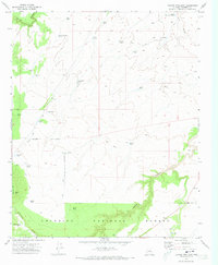
1971 Map of Chavez Mtn East
USGS Topo · Published 1973About this map
Coconino National Forest defines the southern and western portions of this high-desert landscape, where survival and movement are dictated by water and trails. The map documents a complex network of man-made water features such as Melbourne Dam and dozens of livestock tanks, including Lute Hart Tank, Pat Duke Tank, and Pyeatt Tank, which supported ranching in this arid environment. Significant natural drainage systems like Canyon Diablo in the northwest and the winding course of Jacks Canyon in the southeast carve through the terrain, illustrating the geological character of the Colorado Plateau.
Find a feature on this map
38 named features on this map. Tap any name to fly to it.
Don’t see what you’re looking for? This feature index may not catch every label — zoom into the map to look around manually.
Map Details
Editions of this 1971 Chavez Mtn East Map
2 editions found
Other maps of this area

1886 · Holbrook
USGS Topo · 1:250,000

1887 · Verde
USGS Topo · 1:250,000

1892 · Verde
USGS Topo · 1:250,000

1893 · Holbrook
USGS Topo · 1:250,000

1954 · Holbrook
USGS Topo · 1:250,000

1955 · Sunset Knoll 2 SW
USGS Topo · 1:24,000
1955 · Sunset Knoll 2 NW
USGS Topo · 1:24,000

1955 · Sunset Pass
USGS Topo · 1:62,500

1957 · Holbrook
USGS Topo · 1:250,000

1958 · Holbrook
USGS Topo · 1:250,000