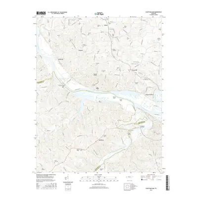
2016 Map of Cheatham Dam
USGS Topo · Published 2016About this map
Cheatham Dam anchors the landscape where the Cumberland River carves through the border of Cheatham and Dickson Counties. This modern survey reflects a region defined by its waterway history and rural longevity, featuring a high density of family cemeteries such as the Bobbitt- Forbes Cem and Wheeless- Green Cem that dot the high ground above the river valley. The confluence of the Harpeth River and Cumberland River near Pack Island remains a focal point of the local geography, alongside river navigation landmarks like Harpeth Shoals and Reids Reef.
Find a feature on this map
136 named features on this map. Tap any name to fly to it.
Don’t see what you’re looking for? This feature index may not catch every label — zoom into the map to look around manually.
Map Details
Editions of this 2016 Cheatham Dam Map
This is the sole edition of this map. No revisions or reprints were ever made.
Other maps of this area

1930 · White Bluff
USGS Topo · 1:62,500

1933 · White Bluff
USGS Topo · 1:62,500

1956 · Nashville
USGS Topo · 1:250,000

1957 · Cheatham Dam
USGS Topo · 1:24,000

1957 · Pleasant View
USGS Topo · 1:24,000

1957 · Henrietta
USGS Topo · 1:24,000

1957 · Ashland City
USGS Topo · 1:24,000

1958 · Charlotte
USGS Topo · 1:24,000

1958 · Cumberland Furnace
USGS Topo · 1:24,000
1958 · Excell
USGS Topo · 1:24,000