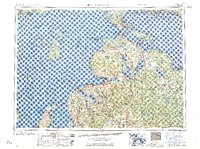
1958 Map of Cheboygan
USGS Topo · Published 1958About this map
The Straits of Mackinac serve as the focal point of this 1950s regional overview, connecting Lake Michigan and Lake Huron while separating the Upper and Lower Peninsulas. Extensive state and national forests, including Pigeon River State Forest and Hardwood State Forest, dominate the interior, punctuated by the massive inland water bodies of Burt Lake, Mullett Lake, and Black Lake. These features reflect a landscape heavily influenced by glacial geography and the burgeoning mid-century timber and recreation industries.
Find a feature on this map
82 named features on this map. Tap any name to fly to it.
Don’t see what you’re looking for? This feature index may not catch every label — zoom into the map to look around manually.
Map Details
Editions of this 1958 Cheboygan Map
2 editions found

Other maps of this area

1931 · St Ignace NW
USGS Topo · 1:31,680

1931 · Pickford SE
USGS Topo · 1:31,680

1931 · Epoufette SE
USGS Topo · 1:31,680

1931 · Seul Choix Point NE
USGS Topo · 1:31,680

1931 · Moran NE
USGS Topo · 1:31,680

1931 · Epoufette SW
USGS Topo · 1:31,680

1931 · Seul Choix Point NW
USGS Topo · 1:31,680

1931 · Manistique River SE
USGS Topo · 1:31,680

1931 · Blaney SW
USGS Topo · 1:31,680

1931 · Gould City SE
USGS Topo · 1:31,680