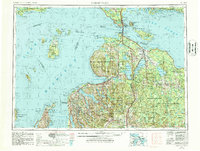
1958 Map of Cheboygan
USGS Topo · Published 1958This historical map portrays the area of Cheboygan in 1958, primarily covering Cheboygan as well as portions of Presque Isle County, Chippewa County, Emmet County, Mackinac County, Montmorency County, Charlevoix County, Schoolcraft County, Otsego County, Grand Traverse County, Antrim County, and Leelanau County. Featuring a scale of 1:250000, this map provides a highly detailed snapshot of the terrain, roads, buildings, counties, and historical landmarks in the Cheboygan region at the time. Published in 1958, it is one of 2 known editions of this map due to revisions or reprints.
Find a feature on this map
114 named features on this map. Tap any name to fly to it.
Don’t see what you’re looking for? This feature index may not catch every label — zoom into the map to look around manually.
Map Details
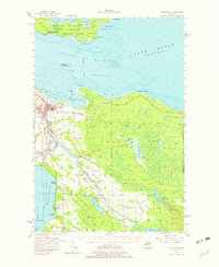
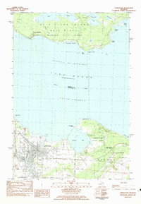
Editions of this 1958 Cheboygan Map
2 editions found
Historical Maps of Orchard Beach Through Time
5 maps found