
1958 Map of Cheboygan
USGS Topo · Published 1958About this map
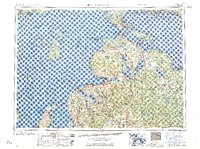
Straits Of Mackinac serve as the central hub of this 1958 topographic study, illustrating the complex maritime and overland connections between Michigan's peninsulas. The map documents a period when the Pennsylvania RR and New York Central RR still dominated the transit landscape, terminating at the water's edge to meet ferries. On the islands, the Beaver Island Indian Reservation and settlements like St James are clearly delineated, alongside the more remote North Manitou Island.
Find a feature on this map
114 named features on this map. Tap any name to fly to it.
Don’t see what you’re looking for? This feature index may not catch every label — zoom into the map to look around manually.
Map Details
Editions of this 1958 Cheboygan Map
2 editions found
Other maps of this area

1931 · St Ignace NW
USGS Topo · 1:31,680

1931 · Pickford SE
USGS Topo · 1:31,680

1931 · Epoufette SE
USGS Topo · 1:31,680

1931 · Seul Choix Point NE
USGS Topo · 1:31,680

1931 · Moran NE
USGS Topo · 1:31,680

1931 · Epoufette SW
USGS Topo · 1:31,680

1931 · Seul Choix Point NW
USGS Topo · 1:31,680

1931 · Manistique River SE
USGS Topo · 1:31,680

1931 · Blaney SW
USGS Topo · 1:31,680

1931 · Gould City SE
USGS Topo · 1:31,680