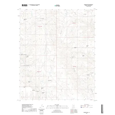
2018 Map of Chediski Peak
USGS Topo · Published 2018About this map
Chediski Peak and the surrounding high ridges of Navajo County are meticulously detailed in this 2018 survey. The landscape is defined by a dense network of canyons and ridges, where the steep topography of The Pyramids and Chediski Mtn rises above deep drainages like Mountain Lion Canyon and Wagon Wheel Canyon. The map reveals a land managed for its natural resources and rugged beauty, marked by isolated water sources such as Chuck Box Lake, Nyce Lake, and Rotten Spring. Navigation through this complex terrain is facilitated by primitive routes like Chediski Lookout Rd and Carrizo Ridge Rd, which follow the natural contours of prominent landforms including Steer Ridge and Whitetail Ridge.
Find a feature on this map
41 named features on this map. Tap any name to fly to it.
Don’t see what you’re looking for? This feature index may not catch every label — zoom into the map to look around manually.
Map Details
Editions of this 2018 Chediski Peak Map
This is the sole edition of this map. No revisions or reprints were ever made.
Other maps of this area

1886 · Holbrook
USGS Topo · 1:250,000

1893 · Holbrook
USGS Topo · 1:250,000

1954 · Holbrook
USGS Topo · 1:250,000

1957 · Holbrook
USGS Topo · 1:250,000

1958 · Holbrook
USGS Topo · 1:250,000

1960 · Holbrook
USGS Topo · 1:250,000

1961 · Woods Canyon
USGS Topo · 1:62,500

1961 · Heber
USGS Topo · 1:62,500

1961 · Chediski Peak
USGS Topo · 1:62,500
1961 · Young
USGS Topo · 1:62,500