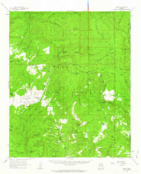
1961 Map of Young
USGS Topo · Published 1963About this map
The Young settlement and the surrounding Pleasant Valley School grounds form the heart of this Gila County survey, situated just before significant modern development in the Mogollon Rim country. The landscape is defined by the high Naegelin Rim and the deep drainage systems of Cherry Creek and Haigler Creek. Local industry and land management are evident through the Asbestos Mill and various administrative outposts like the Pleasant Valley Ranger Station and Red Lake Guard Station. The map captures a transition from isolated ranching outposts like Nail Ranch and Q Ranch to a more managed forest landscape. Notable terrain features such as Catholic Peak, Gentry Mountain, and Graveyard Ridge punctuate the high-elevation mesas, while an Airstrip near the valley floor indicates the increasing accessibility of this once-remote territory during the early 1960s.
Find a feature on this map
74 named features on this map. Tap any name to fly to it.
Don’t see what you’re looking for? This feature index may not catch every label — zoom into the map to look around manually.
Map Details
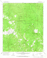
Editions of this 1961 Young Map
2 editions found
Other maps of this area

1886 · Holbrook
USGS Topo · 1:250,000

1887 · Verde
USGS Topo · 1:250,000

1892 · Verde
USGS Topo · 1:250,000

1893 · Holbrook
USGS Topo · 1:250,000

1907 · Roosevelt
USGS Topo · 1:125,000

1909 · Four Peaks
USGS Topo · 1:125,000

1912 · Roosevelt
USGS Topo · 1:125,000

1922 · Chrysotile
USGS Topo · 1:125,000
1934 · Promontory Butte
USGS Topo · 1:62,500
1937 · Diamond Butte
USGS Topo · 1:48,000