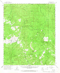
1961 Map of Young
USGS Topo · Published 1967About this map
Pleasant Valley and the community of Young anchor this high-country landscape in the early 1960s, situated between the Naegelin Rim and the Tonto National Forest. The map documents a ranching and industrial economy, visible through the isolated Q Ranch and Flying V Ranch, alongside an Asbestos Mill located near Turkey Creek. Historical local infrastructure is well-represented, including the Pleasant Valley Sch, a local Cem, and the Pleasant Valley Ranger Station. The terrain is characterized by a complex network of canyons and mesas, such as Crouch Mesa and Gentry Mountain, with drainage provided by the prominent Cherry Creek. Toward the east, the boundary of the Fort Apache Indian Reservation meets the Gila Co and Navajo Co line, while an Airstrip and several Jeep Trails suggest the region's reliance on specialized transport for access through the forest and rugged mesas.
Find a feature on this map
74 named features on this map. Tap any name to fly to it.
Don’t see what you’re looking for? This feature index may not catch every label — zoom into the map to look around manually.
Map Details
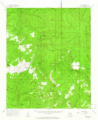
Editions of this 1961 Young Map
2 editions found
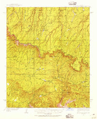
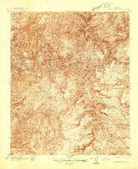
Other maps of this area

1886 · Holbrook
USGS Topo · 1:250,000

1887 · Verde
USGS Topo · 1:250,000

1892 · Verde
USGS Topo · 1:250,000

1893 · Holbrook
USGS Topo · 1:250,000

1907 · Roosevelt
USGS Topo · 1:125,000

1909 · Four Peaks
USGS Topo · 1:125,000

1912 · Roosevelt
USGS Topo · 1:125,000

1922 · Chrysotile
USGS Topo · 1:125,000
1934 · Promontory Butte
USGS Topo · 1:62,500
1937 · Diamond Butte
USGS Topo · 1:48,000