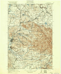
1916 Map of Chehalis
USGS Topo · Published 1916About this map
Centralia and Chehalis serve as the primary hubs in this western Washington landscape, where the Newaukum River and Skookumchuck River converge with a dense network of early 20th-century railroads. The map records a transition from industrial activity to agricultural settlement, evidenced by the Union Lumber Camp and Salmon Creek Mill contrasted against numerous school districts like Brighton Park School and Logan Hill School.
Find a feature on this map
125 named features on this map. Tap any name to fly to it.
Don’t see what you’re looking for? This feature index may not catch every label — zoom into the map to look around manually.
Map Details
Editions of this 1916 Chehalis Map
4 editions found
Other maps of this area

1897 · Tacoma
USGS Topo · 1:125,000

1900 · Tacoma
USGS Topo · 1:125,000

1916 · Chehalis
USGS Topo · 1:125,000

1919 · Mount St Helens
USGS Topo · 1:125,000

1937 · Olympia
USGS Topo · 1:62,500

1937 · Eatonville
USGS Topo · 1:125,000

1939 · Shelton
USGS Topo · 1:62,500

1940 · Tenino
USGS Topo · 1:62,500

1940 · Anderson Island
USGS Topo · 1:62,500

1941 · Meskill
USGS Topo · 1:62,500