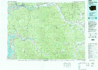
1992 Map of Chehalis River
USGS Topo · Published 1993About this map
The Chehalis River defines the drainage and development of this Washington landscape, flowing from the interior hills toward the complex tidal reaches of Grays Harbor. The industrial and maritime hubs of Aberdeen and Hoquiam sit at the river's mouth, where the North Channel, Middle Channel, and South Channel navigate through a network of islands including Rennie Island and Moon Island. Upriver, the valley supports a string of settlements like Montesano, Elma, and Oakville, many of which developed alongside the Burlington Northern Railroad corridor.
Find a feature on this map
164 named features on this map. Tap any name to fly to it.
Don’t see what you’re looking for? This feature index may not catch every label — zoom into the map to look around manually.
Map Details
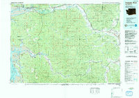
Editions of this 1992 Chehalis River Map
2 editions found
Other maps of this area

1916 · Chehalis
USGS Topo · 1:125,000

1937 · Olympia
USGS Topo · 1:62,500

1938 · Cape Disappointment
USGS Topo · 1:62,500

1938 · Cape Shoalwater
USGS Topo · 1:62,500

1938 · Fort Columbia
USGS Topo · 1:62,500

1938 · Moclips
USGS Topo · 1:62,500

1938 · South Bend
USGS Topo · 1:62,500

1939 · Shelton
USGS Topo · 1:62,500

1940 · Tenino
USGS Topo · 1:62,500

1940 · Montesano
USGS Topo · 1:62,500