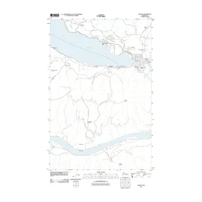
2011 Map of Chelan
USGS Topo · Published 2011About this map
The town of Chelan serves as the hub of this Washington landscape, where the outflow of Lake Chelan meets the Columbia River to the south. The 2011 survey reveals a complex interface between water and infrastructure, notably at the Lake Chelan Dam and the Woodin Avenue Bridge which connects the lakeside community. Significant maritime and transit nodes are visible along the shoreline, including the Chelan Ferry Landing and the Lady of the Lake Commercial Dock, indicating the lake's role as a primary transportation corridor.
Find a feature on this map
71 named features on this map. Tap any name to fly to it.
Don’t see what you’re looking for? This feature index may not catch every label — zoom into the map to look around manually.
Map Details
Editions of this 2011 Chelan Map
This is the sole edition of this map. No revisions or reprints were ever made.
Other maps of this area

1901 · Chelan
USGS Topo · 1:125,000

1953 · Ritzville
USGS Topo · 1:250,000

1957 · Wenatchee
USGS Topo · 1:250,000

1959 · Ritzville
USGS Topo · 1:250,000

1965 · Ritzville
USGS Topo · 1:250,000

1968 · Chelan
USGS Topo · 1:24,000

1968 · Lamoine
USGS Topo · 1:24,000

1968 · Chelan Falls
USGS Topo · 1:24,000
1968 · Azwell
USGS Topo · 1:24,000

1968 · Waterville
USGS Topo · 1:24,000