
1968 Map of Lamoine
USGS Topo · Published 1971About this map
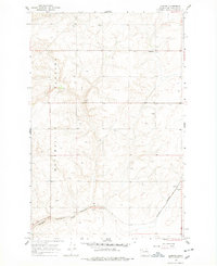
The high, semi-arid expanse of the Waterville Plateau dominates this late 1960s survey, showing a landscape defined by dryland wheat farming and rural resilience in Douglas County. The small community of Lamoine sits at a crossroads in the northern section, surrounded by scattered water management features such as a Cistern or well at nearly every homestead, a necessity in this high-desert environment. Further south, the Burlington Northern railroad cuts through the terrain, serving the agricultural industry anchored at Supplee. Here, a Grain Elevator and Storage Bin mark the vital transport hub for the region's harvests. Genealogical interest is found at the Fletcher Cem near the northern boundary, while the topographic detail traces the deep carved path of the Draw and various industrial operations like the local Gravel Pit.
Find a feature on this map
11 named features on this map. Tap any name to fly to it.
Don’t see what you’re looking for? This feature index may not catch every label — zoom into the map to look around manually.
Map Details
Editions of this 1968 Lamoine Map
2 editions found
Other maps of this area

1901 · Chelan
USGS Topo · 1:125,000

1953 · Ritzville
USGS Topo · 1:250,000

1957 · Wenatchee
USGS Topo · 1:250,000

1959 · Ritzville
USGS Topo · 1:250,000

1965 · Ritzville
USGS Topo · 1:250,000

1968 · Withrow
USGS Topo · 1:24,000

1968 · Chelan
USGS Topo · 1:24,000

1968 · Chelan Falls
USGS Topo · 1:24,000
1968 · Alstown
USGS Topo · 1:24,000
1968 · Mud Spring
USGS Topo · 1:24,000