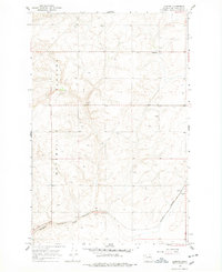
1968 Map of Lamoine
USGS Topo · Published 1978About this map
The high, rolling expanse of the Waterville Plateau dominates this late-1960s landscape, illustrating the agricultural character of Douglas County. The small community of Lamoine sits atop the plateau, characterized by its reliance on collected water as evidenced by the numerous cisterns dotting the surrounding sections. This reliance on stored water highlights the semi-arid nature of the region before modern irrigation reached many of these upland wheat-growing areas.
Find a feature on this map
12 named features on this map. Tap any name to fly to it.
Don’t see what you’re looking for? This feature index may not catch every label — zoom into the map to look around manually.
Map Details
Editions of this 1968 Lamoine Map
2 editions found
Other maps of this area

1901 · Chelan
USGS Topo · 1:125,000

1953 · Ritzville
USGS Topo · 1:250,000

1957 · Wenatchee
USGS Topo · 1:250,000

1959 · Ritzville
USGS Topo · 1:250,000

1965 · Ritzville
USGS Topo · 1:250,000

1968 · Withrow
USGS Topo · 1:24,000

1968 · Chelan
USGS Topo · 1:24,000

1968 · Lamoine
USGS Topo · 1:24,000

1968 · Chelan Falls
USGS Topo · 1:24,000
1968 · Alstown
USGS Topo · 1:24,000