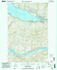
2004 Map of Chelan
USGS Topo · Published 2008About this map
Lake Chelan dominates the northern landscape of this region, serving as the focal point for the lakeside communities of Chelan and Lakeside. The terrain transitions sharply from the deep waters of the lake to the high elevations of Chelan Butte, where the Chelan State Wildlife Area occupies the high ground between the lake and the Columbia River to the south. Along the Columbia, the map reveals a different character of settlement at Dover Flat and Stayman, where the Lake Entiat reservoir forms a wide waterway below the steep canyon walls. Local history is anchored by sites like the Chelan Fraternal Cem and industrial markers such as Gravel Pits and various pumping stations that support the orchards and homes near Minneapolis Beach and along the South Lakeshore Road.
Find a feature on this map
33 named features on this map. Tap any name to fly to it.
Don’t see what you’re looking for? This feature index may not catch every label — zoom into the map to look around manually.
Map Details
Editions of this 2004 Chelan Map
This is the sole edition of this map. No revisions or reprints were ever made.
Other maps of this area

1901 · Chelan
USGS Topo · 1:125,000

1953 · Ritzville
USGS Topo · 1:250,000

1957 · Wenatchee
USGS Topo · 1:250,000

1959 · Ritzville
USGS Topo · 1:250,000

1965 · Ritzville
USGS Topo · 1:250,000

1968 · Chelan
USGS Topo · 1:24,000

1968 · Lamoine
USGS Topo · 1:24,000

1968 · Chelan Falls
USGS Topo · 1:24,000
1968 · Azwell
USGS Topo · 1:24,000

1968 · Waterville
USGS Topo · 1:24,000