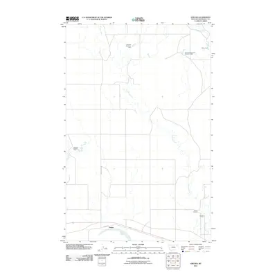
2011 Map of Chelsea
USGS Topo · Published 2011About this map
Boxelder Creek meanders through this portion of the Fort Peck Indian Reservation, defining the drainage patterns of the eastern Montana plains. The settlement of Chelsea sits near the southern edge of the sheet along the Missouri River floodplain, marked by the nearby Chelsea Slough and the winding Chelsea Creek. This landscape is characterized by a network of local water management features, including the Dolezilek Reservoir Dam, Wilma Dam, and Aytolloha Number 1 Dam, which support the region's agricultural and ranching operations. For those researching local heritage, the map identifies significant burial sites including Saint Anns Cemetery and Boxelder Cemetery, providing specific locations for these community landmarks. The infrastructure of the area is tied together by the Indian Hwy and the local Chelsea Loop Rd, which provide access across the wide drainage of Little Badger Creek and the surrounding rangeland.
Find a feature on this map
13 named features on this map. Tap any name to fly to it.
Don’t see what you’re looking for? This feature index may not catch every label — zoom into the map to look around manually.
Map Details
Editions of this 2011 Chelsea Map
This is the sole edition of this map. No revisions or reprints were ever made.
Other maps of this area

1910 · Cuskers
USGS Topo · 1:62,500

1912 · Chelsea
USGS Topo · 1:62,500

1912 · Hay Creek
USGS Topo · 1:62,500

1912 · Poplar
USGS Topo · 1:62,500

1915 · Cuskers
USGS Topo · 1:62,500

1954 · Wolf Point
USGS Topo · 1:250,000

1958 · Wolf Point
USGS Topo · 1:250,000

1972 · Chelsea SW
USGS Topo · 1:24,000

1972 · Poplar
USGS Topo · 1:24,000

1972 · Chelsea
USGS Topo · 1:24,000