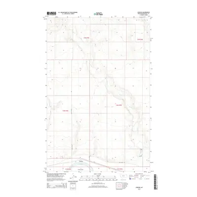
2014 Map of Chelsea
USGS Topo · Published 2014About this map
Chelsea sits along the northern banks of the Missouri River corridor, characterized by the riparian environment of Chelsea Slough and the nearby Chelsea Island. The landscape is defined by the winding drainage of Boxelder Cr, which cuts through the plains from the north to meet the river valley. This 2014 survey documents a predominantly rural infrastructure where local travel relies on routes like Chelsea Loop Rd and Red Thunder Rd. Evidence of the area's social history and early settlement is preserved in the location of Boxelder Cem and Saint Anns Cem, both situated near the lower reaches of Boxelder Cr. The northern reaches of the quadrangle are primarily open terrain, drained by Little Badger Cr and the upper branches of local creek systems.
Find a feature on this map
19 named features on this map. Tap any name to fly to it.
Don’t see what you’re looking for? This feature index may not catch every label — zoom into the map to look around manually.
Map Details
Editions of this 2014 Chelsea Map
This is the sole edition of this map. No revisions or reprints were ever made.
Other maps of this area

1910 · Cuskers
USGS Topo · 1:62,500

1912 · Chelsea
USGS Topo · 1:62,500

1912 · Hay Creek
USGS Topo · 1:62,500

1912 · Poplar
USGS Topo · 1:62,500

1915 · Cuskers
USGS Topo · 1:62,500

1954 · Wolf Point
USGS Topo · 1:250,000

1958 · Wolf Point
USGS Topo · 1:250,000

1972 · Chelsea SW
USGS Topo · 1:24,000

1972 · Poplar
USGS Topo · 1:24,000

1972 · Chelsea
USGS Topo · 1:24,000