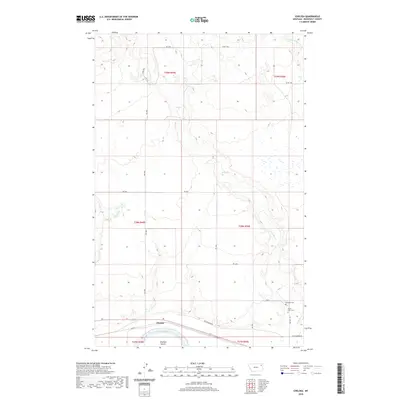
2020 Map of Chelsea
USGS Topo · Published 2020About this map
The settlement of Chelsea sits along the northern banks of the Missouri River in Roosevelt County, where the water bifurcates around Chelsea Island and the Chelsea Slough. This modern survey reveals a landscape defined by its riparian geometry and the vast ranching and agricultural tracts typical of the Poplar District. Near the confluence of Boxelder Cr and the Missouri, local history is anchored by the Saint Ann's Cem and Boxelder Cem, providing a window into the lineage of the local families and the tribal communities of the Fort Peck Reservation. The terrain is marked by the winding courses of Chelsea Cr and Little Badger Cr, which carve through the plains to the north. A network of Bureau of Indian Affairs routes and rural roads, including Bia Rte 1 and Red Thunder Rd, connect the scattered homesteads and cemetery sites across the township sections.
Find a feature on this map
25 named features on this map. Tap any name to fly to it.
Don’t see what you’re looking for? This feature index may not catch every label — zoom into the map to look around manually.
Map Details
Editions of this 2020 Chelsea Map
This is the sole edition of this map. No revisions or reprints were ever made.
Other maps of this area

1910 · Cuskers
USGS Topo · 1:62,500

1912 · Chelsea
USGS Topo · 1:62,500

1912 · Hay Creek
USGS Topo · 1:62,500

1912 · Poplar
USGS Topo · 1:62,500

1915 · Cuskers
USGS Topo · 1:62,500

1954 · Wolf Point
USGS Topo · 1:250,000

1958 · Wolf Point
USGS Topo · 1:250,000

1972 · Chelsea SW
USGS Topo · 1:24,000

1972 · Poplar
USGS Topo · 1:24,000

1972 · Chelsea
USGS Topo · 1:24,000