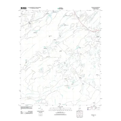
2011 Map of Chelsea
USGS Topo · Published 2011About this map
Oak Mountain Lake and a complex series of reservoirs and dams define this Shelby County landscape, showing the area as it transitioned into a suburban corridor south of Birmingham. The topography is marked by the distinct ridges and gaps of the Appalachian foothills, including The Narrows and Shackleford Gap. This 2011 survey documents the dense network of residential subdivisions and mountain roads such as Oak Mountain Park Rd and Co Hwy-11, which have overwritten much of the earlier rural character. Genealogists will find a significant concentration of burial sites, ranging from the Old Acton Cemetery in the northwest to the Mose Davis Cemetery in the southeast. Small historic community centers like New Hope, Watkins, and East Saginaw remain as named locations, while the Chelsea Post Office serves as the focal point for the growing town of Chelsea.
Find a feature on this map
151 named features on this map. Tap any name to fly to it.
Don’t see what you’re looking for? This feature index may not catch every label — zoom into the map to look around manually.
Map Details
Editions of this 2011 Chelsea Map
This is the sole edition of this map. No revisions or reprints were ever made.
Other maps of this area

1890 · Bessemer
USGS Topo · 1:125,000

1892 · Bessemer
USGS Topo · 1:125,000

1905 · Bessemer Iron District
USGS Topo · 1:62,500

1906 · Vandiver
USGS Topo · 1:62,500

1907 · Bessemer Special
USGS Topo · 1:62,500

1908 · Vandiver
USGS Topo · 1:62,500

1909 · Columbiana
USGS Topo · 1:62,500

1910 · Montevallo
USGS Topo · 1:62,500

1911 · Columbiana
USGS Topo · 1:62,500

1953 · Birmingham
USGS Topo · 1:250,000