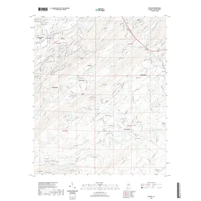
2020 Map of Chelsea
USGS Topo · Published 2020About this map
New Hope Mtn and Oak Mtn define the ridge-and-valley landscape of this Shelby County area, where suburban growth meets the complex topography of the southern Appalachians. The terrain is crisscrossed by an extensive network of recreational paths, including the Seven Bridges Trail, Thunder Trail, and the S Rim Trail, which navigate the steep elevations between Pelham and Chelsea. Historically significant sites are scattered throughout the valleys, such as the New Hope Ch and numerous family burial grounds including Bailey Cem and Poindexter-Vick Cem. This modern survey records the persistence of older place names like East Saginaw and Simmsville even as newer residential developments and utility corridors, such as the power lines near Morris Bridge, reshape the land. The drainage patterns of the N Fork Yellowleaf Cr and Cahaba Valley Cr continue to dictate the placement of roads and settlements.
Find a feature on this map
209 named features on this map. Tap any name to fly to it.
Don’t see what you’re looking for? This feature index may not catch every label — zoom into the map to look around manually.
Map Details
Editions of this 2020 Chelsea Map
This is the sole edition of this map. No revisions or reprints were ever made.
Other maps of this area

1890 · Bessemer
USGS Topo · 1:125,000

1892 · Bessemer
USGS Topo · 1:125,000

1905 · Bessemer Iron District
USGS Topo · 1:62,500

1906 · Vandiver
USGS Topo · 1:62,500

1907 · Bessemer Special
USGS Topo · 1:62,500

1908 · Vandiver
USGS Topo · 1:62,500

1909 · Columbiana
USGS Topo · 1:62,500

1910 · Montevallo
USGS Topo · 1:62,500

1911 · Columbiana
USGS Topo · 1:62,500

1953 · Birmingham
USGS Topo · 1:250,000