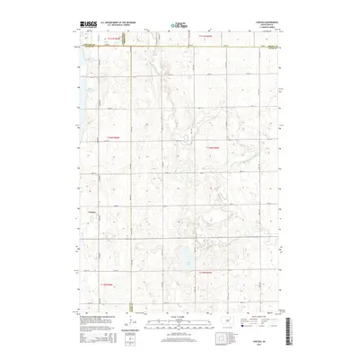
2015 Map of Chelsea
USGS Topo · Published 2015About this map
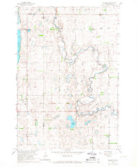
Chelsea serves as the primary hub of this eastern South Dakota prairie landscape, situated near the intersection of 372nd Ave and 153rd St. The surrounding terrain is defined by a series of significant water bodies and drainage systems, including the sprawling Alkali Lake to the southeast and the twin basins of North Scatterwood Lake and South Scatterwood Lake on the western edge. These features, along with the meandering course of Snake Creek, indicate a landscape shaped by glacial depressions common to the James River Valley region. The map captures a strictly organized section-line road grid, where routes like 148th St and 374th Ave define the boundaries between Faulk, Edmunds, Brown, and Spink counties. This intersection of four county lines provides a rare look at the jurisdictional convergence in a rural agricultural setting during the early 21st century.
Find a feature on this map
30 named features on this map. Tap any name to fly to it.
Don’t see what you’re looking for? This feature index may not catch every label — zoom into the map to look around manually.
Map Details
Editions of this 2015 Chelsea Map
This is the sole edition of this map. No revisions or reprints were ever made.
Other maps of this area

1899 · Northville
USGS Topo · 1:125,000

1954 · Aberdeen
USGS Topo · 1:250,000

1956 · Aberdeen
USGS Topo · 1:250,000

1960 · Rudolph
USGS Topo · 1:24,000
1960 · Northville
USGS Topo · 1:24,000
1960 · Athol
USGS Topo · 1:24,000

1966 · Cresbard SE
USGS Topo · 1:24,000
1966 · Northville SW
USGS Topo · 1:24,000
1966 · Chelsea
USGS Topo · 1:24,000
1966 · Cresbard NE
USGS Topo · 1:24,000