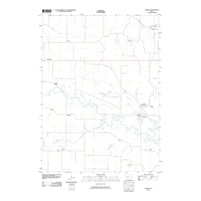
2010 Map of Chelsea
USGS Topo · Published 2010About this map
The Iowa River carves a meandering path through this Iowa landscape, defining the character of the river valley between Helena and Chelsea. This corridor is dense with genealogical landmarks, particularly along the winding tributaries of Richland Creek and Otter Creek. The map documents a scattered network of rural burial sites, from the Saint Josephs Cemetery and the Independent Order of Odd Fellows Cemetery near the river, to isolated locations like the Rector Cemetery and Hayes Cemetery on the periphery.
Find a feature on this map
35 named features on this map. Tap any name to fly to it.
Don’t see what you’re looking for? This feature index may not catch every label — zoom into the map to look around manually.
Map Details
Editions of this 2010 Chelsea Map
This is the sole edition of this map. No revisions or reprints were ever made.
Other maps of this area

1954 · Waterloo
USGS Topo · 1:250,000

1954 · Des Moines
USGS Topo · 1:250,000

1955 · Waterloo
USGS Topo · 1:250,000

1956 · Des Moines
USGS Topo · 1:250,000

1957 · Des Moines
USGS Topo · 1:250,000

1968 · Belle Plaine SW
USGS Topo · 1:24,000

1968 · Belle Plaine
USGS Topo · 1:24,000

1968 · Chelsea
USGS Topo · 1:24,000

1968 · Hartwick
USGS Topo · 1:24,000

1969 · Des Moines
USGS Topo · 1:250,000