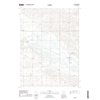
2018 Map of Chelsea
USGS Topo · Published 2018About this map
The Iowa River valley dominates this landscape, where complex wetland patterns and old river bends create a broad flood plain south of Long Point. The settlement of Chelsea sits at the junction of this river system and Plague Mine Cr, serving as a central point for the surrounding agricultural townships. The map reveals a dense network of rural heritage sites, particularly numerous family and community burial grounds such as Stayskal Cem, Day Cem, and the Independent Order of Odd Fellows Cem. North of the river, the terrain shifts into the dissected uplands of t83n r14w, where small communities like Vining and Gladstone are connected by a grid of county roads. Further south, the course of Richland Creek meanders toward Rainbow Lake, illustrating the intricate drainage system that has historically shaped farming and settlement in this portion of Tama County.
Find a feature on this map
42 named features on this map. Tap any name to fly to it.
Don’t see what you’re looking for? This feature index may not catch every label — zoom into the map to look around manually.
Map Details
Editions of this 2018 Chelsea Map
This is the sole edition of this map. No revisions or reprints were ever made.
Other maps of this area

1954 · Waterloo
USGS Topo · 1:250,000

1954 · Des Moines
USGS Topo · 1:250,000

1955 · Waterloo
USGS Topo · 1:250,000

1956 · Des Moines
USGS Topo · 1:250,000

1957 · Des Moines
USGS Topo · 1:250,000

1968 · Belle Plaine SW
USGS Topo · 1:24,000

1968 · Belle Plaine
USGS Topo · 1:24,000

1968 · Chelsea
USGS Topo · 1:24,000

1968 · Hartwick
USGS Topo · 1:24,000

1969 · Des Moines
USGS Topo · 1:250,000