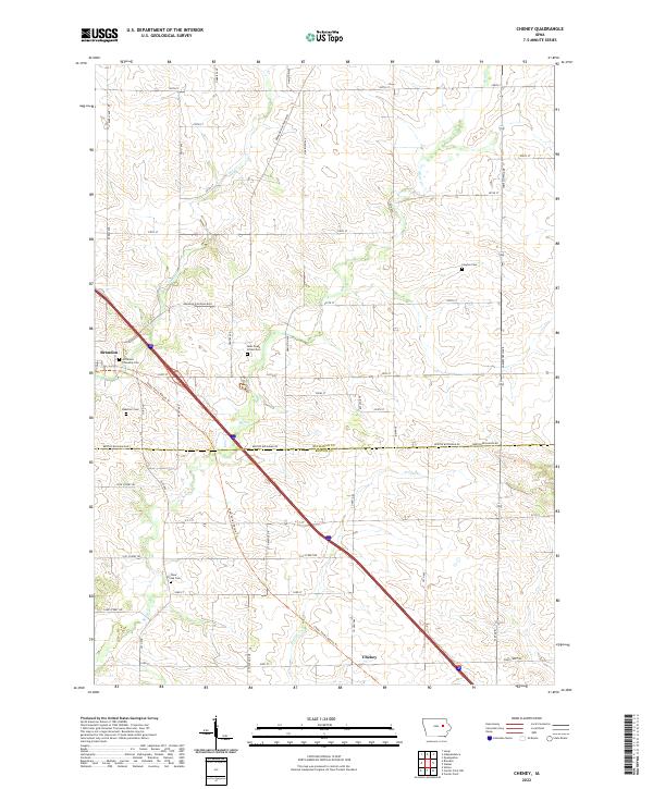
2022 Map of Cheney
USGS Topo · Published 2022About this map
Brandon and the crossroads of Cheney anchor this survey of the Iowa landscape along the Buchanan Co Benton Co line. The terrain is defined by the winding paths of Bear Cr, Lime Cr, and Prairie Cr, which cut through a dense grid of rural township roads and agricultural sections. The modern Cedar Valley Nature Trl follows a diagonal route through the area, tracing a path that historically connected these farming communities. This map is particularly notable for its preservation of local history through numerous burial sites, including Jefferson Township Cem, Clayton Cem, Beachler Cem, and two distinct locations named Bear Creek Cem and Bear Creek School Cem. These landmarks, along with the detailed network of secondary routes like Brandon Diagonal Blvd and Benton Buchanan Rd, provide a precise record of the regional geography in the early 21st century.
Find a feature on this map
48 named features on this map. Tap any name to fly to it.
Don’t see what you’re looking for? This feature index may not catch every label — zoom into the map to look around manually.
Map Details
Editions of this 2022 Cheney Map
This is the sole edition of this map. No revisions or reprints were ever made.
Other maps of this area

1888 · Shellsburg
USGS Topo · 1:62,500

1889 · Shellsburg
USGS Topo · 1:62,500

1899 · Shellsburg
USGS Topo · 1:62,500

1903 · Winthrop
USGS Topo · 1:125,000

1954 · Waterloo
USGS Topo · 1:250,000

1955 · Waterloo
USGS Topo · 1:250,000

1959 · Dubuque
USGS Topo · 1:250,000

1961 · Dubuque
USGS Topo · 1:250,000

1962 · Dubuque
USGS Topo · 1:250,000
1968 · Center Point
USGS Topo · 1:24,000