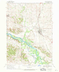
1968 Map of Center Point
USGS Topo · Published 1971About this map
Center Point and the neighboring settlement of Urbana anchor this late-1960s landscape, which is defined by the winding course of the Cedar River and its accompanying wetlands. The river's influence is evident in the cluster of water bodies like Ice House Lake, Goose Pond, and Big Lewis Lake, providing a contrast to the surrounding agricultural uplands. Rural life is well-documented through numerous small cemeteries and houses of worship, including the Cedar Ridge Ch near Cedar Ridge and the Primitive Baptist Ch located further south.
Find a feature on this map
33 named features on this map. Tap any name to fly to it.
Don’t see what you’re looking for? This feature index may not catch every label — zoom into the map to look around manually.
Map Details
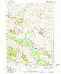
Editions of this 1968 Center Point Map
2 editions found
Other maps of this area

1888 · Shellsburg
USGS Topo · 1:62,500

1888 · Marion
USGS Topo · 1:62,500

1889 · Marion
USGS Topo · 1:62,500

1889 · Shellsburg
USGS Topo · 1:62,500

1899 · Shellsburg
USGS Topo · 1:62,500

1903 · Winthrop
USGS Topo · 1:125,000

1959 · Dubuque
USGS Topo · 1:250,000

1961 · Dubuque
USGS Topo · 1:250,000

1962 · Dubuque
USGS Topo · 1:250,000
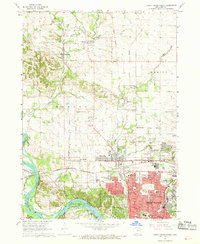
1967 · Cedar Rapids North
USGS Topo · 1:24,000