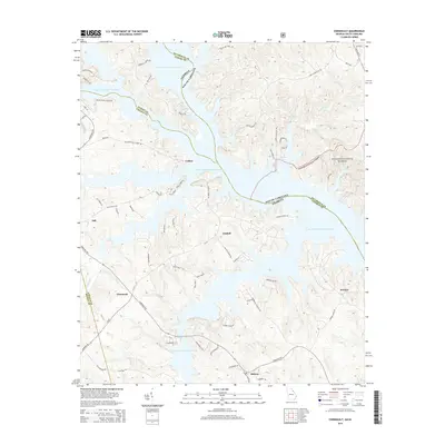
2014 Map of Chennault
USGS Topo · Published 2014About this map
J. Storm Thurmond Reservoir dominates the landscape at the meeting point of Georgia and South Carolina, its winding shoreline shaping the development of Lisbon, Graball, and Chennault. This survey captures the rural character of Lincoln and Elbert counties, where the forest canopy of Sumter National Forest meets the inundated valleys of the Savannah River system. The map details a complex network of local roads such as Hester Bottoms Rd and Broad River Scenic Dr, which provide access to numerous points along the water including Gills Point Rd and Lakeshore Dr. Smaller settlements like Midway, Honora, and Gill are noted along the upland ridges, while the low-lying Hester Bottoms and drainage from Newford Cr define the hydrological layout of the region.
Find a feature on this map
68 named features on this map. Tap any name to fly to it.
Don’t see what you’re looking for? This feature index may not catch every label — zoom into the map to look around manually.
Map Details
Editions of this 2014 Chennault Map
This is the sole edition of this map. No revisions or reprints were ever made.
Other maps of this area

1892 · Mc Cormick
USGS Topo · 1:125,000

1892 · Abbeville
USGS Topo · 1:125,000

1893 · Elberton
USGS Topo · 1:125,000

1906 · Crawfordville
USGS Topo · 1:125,000

1912 · Mc Cormick
USGS Topo · 1:125,000

1949 · Calhoun Creek
USGS Topo · 1:24,000

1953 · Athens
USGS Topo · 1:250,000

1954 · Metasville
USGS Topo · 1:24,000

1954 · Greenville
USGS Topo · 1:250,000

1955 · Tignall
USGS Topo · 1:24,000