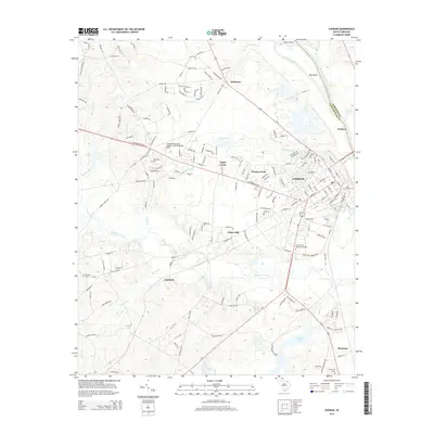
2014 Map of Cheraw
USGS Topo · Published 2014About this map
The Pee Dee River and its tributary, the Little Pee Dee River, shape the eastern border of this region where the Chesterfield and Marlboro county lines meet. The town of Cheraw serves as a central hub, surrounded by several smaller residential clusters like Windsor Park, Fisher Hill, and Kimberly. This 2014 survey reveals a landscape of established transit and civic infrastructure, anchored by the Cheraw Municipal Airport/Lynch Bellinger Field and a network of local roads such as the Chesterfield Hwy.
Find a feature on this map
85 named features on this map. Tap any name to fly to it.
Don’t see what you’re looking for? This feature index may not catch every label — zoom into the map to look around manually.
Map Details
Editions of this 2014 Cheraw Map
This is the sole edition of this map. No revisions or reprints were ever made.
Other maps of this area

1941 · Spartanburg
USGS Topo · 1:250,000

1942 · Rockingham
USGS Topo · 1:125,000

1953 · Florence
USGS Topo · 1:250,000

1953 · Spartanburg
USGS Topo · 1:250,000

1954 · Florence
USGS Topo · 1:250,000

1960 · Spartanburg
USGS Topo · 1:250,000

1963 · Spartanburg
USGS Topo · 1:250,000

1964 · Spartanburg
USGS Topo · 1:250,000

1968 · Chesterfield
USGS Topo · 1:24,000

1968 · Patrick
USGS Topo · 1:24,000