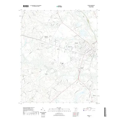
2020 Map of Cheraw
USGS Topo · Published 2020About this map
Cheraw sits along the Pee Dee River at a vital crossing where the coastal plain meets the Sandhills. This contemporary survey shows the city's modern expansion into neighborhoods like Windsor Park and Fisher Hill, while maintaining its deep ties to the regional landscape. The transition from industrial and municipal development to rural farmland is evident in the surrounding settlements of Kimberly and Montrose. Notable institutional landmarks include the Northeastern Technical College and the Cheraw Municipal Airport Lynch Bellinger Field northwest of the city center.
Find a feature on this map
143 named features on this map. Tap any name to fly to it.
Don’t see what you’re looking for? This feature index may not catch every label — zoom into the map to look around manually.
Map Details
Editions of this 2020 Cheraw Map
This is the sole edition of this map. No revisions or reprints were ever made.
Other maps of this area

1941 · Spartanburg
USGS Topo · 1:250,000

1942 · Rockingham
USGS Topo · 1:125,000

1953 · Florence
USGS Topo · 1:250,000

1953 · Spartanburg
USGS Topo · 1:250,000

1954 · Florence
USGS Topo · 1:250,000

1960 · Spartanburg
USGS Topo · 1:250,000

1963 · Spartanburg
USGS Topo · 1:250,000

1964 · Spartanburg
USGS Topo · 1:250,000

1968 · Chesterfield
USGS Topo · 1:24,000

1968 · Patrick
USGS Topo · 1:24,000