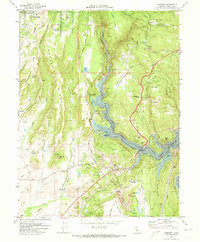
1970 Map of Cherokee
USGS Topo · Published 1973About this map
The West Branch Feather River carves through the center of this 1970s landscape, where the waters of the Lake Oroville State Recreational Area meet the historic mining country of Butte County. Industrial history is etched into the terrain at the Cherokee Placer Mine and the New Era Mine, while massive piles of 30 Dredge Tailings remain near the Pacific Western Railroad tracks. The transition from industrial extraction to modern recreation and infrastructure is visible in the presence of the Lime Saddle Powerhouse and the Paradise Airport Skypark on the western ridges.
Find a feature on this map
57 named features on this map. Tap any name to fly to it.
Don’t see what you’re looking for? This feature index may not catch every label — zoom into the map to look around manually.
Map Details
Editions of this 1970 Cherokee Map
2 editions found
Other maps of this area

1888 · Bidwell Bar
USGS Topo · 1:125,000

1891 · Bidwell Bar
USGS Topo · 1:125,000

1891 · Chico
USGS Topo · 1:125,000

1893 · Chico
USGS Topo · 1:125,000

1893 · Bidwell Bar
USGS Topo · 1:125,000

1895 · Bidwell Bar
USGS Topo · 1:125,000

1895 · Chico
USGS Topo · 1:125,000

1897 · Bidwell Bar
USGS Topo · 1:125,000

1912 · Dry Creek
USGS Topo · 1:31,680

1912 · Oroville
USGS Topo · 1:31,680