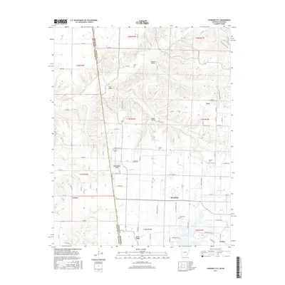
2017 Map of Cherokee City
USGS Topo · Published 2017About this map
Cherokee City and the surrounding borderlands of Benton County and Delaware County appear in high detail at the edge of the Ozarks. The landscape is defined by its dendritic drainage patterns, with Spavinaw Creek and its many tributaries, including Columbia Hollow Creek and Coon Creek, carving through the plateau. Small residential clusters and family-named landmarks suggest a deep-rooted local history, with numerous burial grounds like Falling Springs Cemetery and Bozarth Cemetery situated along the winding rural roads.
Find a feature on this map
91 named features on this map. Tap any name to fly to it.
Don’t see what you’re looking for? This feature index may not catch every label — zoom into the map to look around manually.
Map Details
Editions of this 2017 Cherokee City Map
This is the sole edition of this map. No revisions or reprints were ever made.
Other maps of this area

1899 · Fayetteville
USGS Topo · 1:125,000

1899 · Siloam Springs
USGS Topo · 1:125,000

1901 · Fayetteville
USGS Topo · 1:125,000

1903 · Siloam Springs
USGS Topo · 1:125,000

1904 · Siloam Springs
USGS Topo · 1:125,000

1904 · Fayetteville
USGS Topo · 1:125,000

1954 · Tulsa
USGS Topo · 1:250,000

1958 · Tulsa
USGS Topo · 1:250,000

1963 · Tulsa
USGS Topo · 1:250,000

1970 · Gallatin
USGS Topo · 1:24,000