2024 Map of Cherokee City
USGS Topo · Published 2024About this map
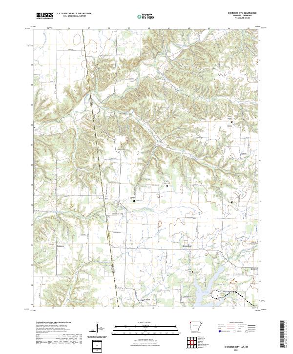
Cherokee City and the neighboring community of Bloomfield sit at the heart of this Western Benton County landscape, where the Ozark plateau meets the state line. The survey documents a complex network of rural life defined by numerous small cemeteries and winding watercourses. Significant landmarks for local history include Falling Springs Cem, Bozarth Cem, and Bloomfield Cem, which are scattered throughout the hills. The terrain is deeply incised by drainages such as Coon Hollow and Columbia Hollow, while Spavinaw Creek and Coon Creek carry water toward the border. To the south, the industrial and recreational impact of Lake Flint Creek is visible near Gentry, contrasting with the more traditional agricultural patterns found around West Point and Ionia. This contemporary view captures the area's rural character as it transitions between the higher elevations and the lower creek basins near the Oklahoma border.
Find a feature on this map
94 named features on this map. Tap any name to fly to it.
Don’t see what you’re looking for? This feature index may not catch every label — zoom into the map to look around manually.
Map Details
Editions of this 2024 Cherokee City Map
This is the sole edition of this map. No revisions or reprints were ever made.