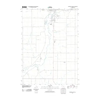
2010 Map of Cherokee South
USGS Topo · Published 2010About this map
The Little Sioux River meanders south from Cherokee in this early 21st-century documentation of the Iowa landscape. This area is defined by its agricultural grid and the natural curves of the waterway, which is flanked by the Cherokee County Fairground and Cherokee Municipal Airport at the northern edge. Significant local history is preserved in the placement of several burial grounds, including Oak Hill Cemetery, West Point Cemetery, and Good Hope Cemetery, which serve as vital landmarks for genealogical research in Cherokee County.
Find a feature on this map
39 named features on this map. Tap any name to fly to it.
Don’t see what you’re looking for? This feature index may not catch every label — zoom into the map to look around manually.
Map Details
Editions of this 2010 Cherokee South Map
This is the sole edition of this map. No revisions or reprints were ever made.
Other maps of this area

1954 · Fort Dodge
USGS Topo · 1:250,000

1957 · Fort Dodge
USGS Topo · 1:250,000

1958 · Fort Dodge
USGS Topo · 1:250,000

1969 · Aurelia
USGS Topo · 1:24,000

1969 · Cleghorn
USGS Topo · 1:24,000

1969 · Cherokee South
USGS Topo · 1:24,000

1969 · Galva
USGS Topo · 1:24,000

1969 · Quimby SE
USGS Topo · 1:24,000
1969 · Washta
USGS Topo · 1:24,000
1969 · Quimby
USGS Topo · 1:24,000