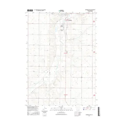
2015 Map of Cherokee South
USGS Topo · Published 2015About this map
The Little Sioux River meanders southward through the center of this terrain, shaping the development of Cherokee and the outlying rural townships. The settlement pattern here is deeply tied to the river valley and its tributaries like Perry Cr and Silver Cr, where the grid-like county road system adjusts for the winding watercourse. In the northern reaches of the map, Cherokee expands near Onawa Junction and Railroad St, reflecting its historical reliance on the rail corridor.
Find a feature on this map
42 named features on this map. Tap any name to fly to it.
Don’t see what you’re looking for? This feature index may not catch every label — zoom into the map to look around manually.
Map Details
Editions of this 2015 Cherokee South Map
This is the sole edition of this map. No revisions or reprints were ever made.
Other maps of this area

1954 · Fort Dodge
USGS Topo · 1:250,000

1957 · Fort Dodge
USGS Topo · 1:250,000

1958 · Fort Dodge
USGS Topo · 1:250,000

1969 · Aurelia
USGS Topo · 1:24,000

1969 · Cleghorn
USGS Topo · 1:24,000

1969 · Cherokee South
USGS Topo · 1:24,000

1969 · Galva
USGS Topo · 1:24,000

1969 · Quimby SE
USGS Topo · 1:24,000
1969 · Washta
USGS Topo · 1:24,000
1969 · Quimby
USGS Topo · 1:24,000