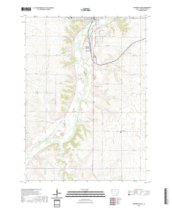
2022 Map of Cherokee South
USGS Topo · Published 2022About this map
The Little Sioux River carves a winding path through this Iowa landscape, defining the topography south of the county seat. The town's southern reach is anchored by the Cherokee County Courthouse and the Cherokee County Regional Airport, while the settlement of Onawa Junction sits at a transition between the river valley and the uplands. The distribution of local history is marked by established burial grounds including Oak Hill Cem in the north and the more isolated Good Hope Cem and West Point Cem to the south. Tributaries like Perry Cr, Coonley Cr, and Silver Cr intersect the township grid, illustrating the drainage patterns that have dictated agricultural boundaries for generations. A notable landmark, Pilot Rock, stands as a prominent natural feature amidst the section lines and rural road network.
Find a feature on this map
53 named features on this map. Tap any name to fly to it.
Don’t see what you’re looking for? This feature index may not catch every label — zoom into the map to look around manually.
Map Details
Editions of this 2022 Cherokee South Map
This is the sole edition of this map. No revisions or reprints were ever made.
Other maps of this area

1954 · Fort Dodge
USGS Topo · 1:250,000

1957 · Fort Dodge
USGS Topo · 1:250,000

1958 · Fort Dodge
USGS Topo · 1:250,000

1969 · Aurelia
USGS Topo · 1:24,000

1969 · Cleghorn
USGS Topo · 1:24,000

1969 · Cherokee South
USGS Topo · 1:24,000

1969 · Galva
USGS Topo · 1:24,000

1969 · Quimby SE
USGS Topo · 1:24,000
1969 · Washta
USGS Topo · 1:24,000
1969 · Quimby
USGS Topo · 1:24,000