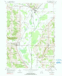
1954 Map of Cherry Creek
USGS Topo · Published 1990About this map
The village of South Dayton serves as a major waypoint in this mid-century survey of the Chautauqua and Cattaraugus county line. The Erie RR defines the local economy, cutting northwest through the landscape with a dedicated RR Sta serving the village of Cherry Creek. This rural corridor is characterized by its numerous "Corners" — small named intersections like Balcom Corners, Meyers Corners, and Kings School Corner that speak to the legacy of family-farm clusters.
Find a feature on this map
45 named features on this map. Tap any name to fly to it.
Don’t see what you’re looking for? This feature index may not catch every label — zoom into the map to look around manually.
Map Details
Editions of this 1954 Cherry Creek Map
3 editions found
Other maps of this area

1900 · Cherry Creek
USGS Topo · 1:62,500

1905 · Jamestown
USGS Topo · 1:62,500

1922 · Randolph
USGS Topo · 1:62,500

1923 · Randolph
USGS Topo · 1:62,500

1923 · Cattaraugus
USGS Topo · 1:62,500

1938 · Cattaraugus
USGS Topo · 1:62,500

1941 · Cattaraugus
USGS Topo · 1:62,500

1941 · Cherry Creek
USGS Topo · 1:62,500

1942 · Jamestown
USGS Topo · 1:62,500

1943 · Randolph
USGS Topo · 1:62,500