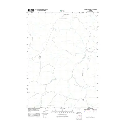
2012 Map of Cherry Creek Hill
USGS Topo · Published 2012About this map
The Middle Fork Powder River carves through this high-plains landscape in Washakie County, defining the drainage patterns for numerous seasonal creeks. The terrain is marked by significant elevation changes, most notably at Cherry Creek Hill, which overlooks the surrounding basin. This 2012 USGS survey reflects a region primarily shaped by ranching and resource access, with the road network including Hazelton Rd and 33 Mile Rd providing critical transit through the open range. Water sources like Bar C Cr and Rock Cr are vital features in this arid environment, while Kidd Flat provides a rare stretch of level ground amidst the dissected hills. The mapping of these ephemeral streams and minor roads illustrates the infrastructure required to manage and navigate the expansive Wyoming interior.
Find a feature on this map
15 named features on this map. Tap any name to fly to it.
Don’t see what you’re looking for? This feature index may not catch every label — zoom into the map to look around manually.
Map Details
Editions of this 2012 Cherry Creek Hill Map
This is the sole edition of this map. No revisions or reprints were ever made.
Other maps of this area

1952 · Grave Spring
USGS Topo · 1:24,000

1952 · Badwater NE
USGS Topo · 1:24,000

1955 · Arminto
USGS Topo · 1:250,000

1958 · Arminto
USGS Topo · 1:250,000

1962 · Arminto
USGS Topo · 1:250,000

1967 · Mahogany Butte
USGS Topo · 1:24,000

1967 · Horse Butte
USGS Topo · 1:24,000

1967 · Gordon Creek
USGS Topo · 1:24,000

1967 · Turk Springs
USGS Topo · 1:24,000
1967 · Cherry Creek Hill
USGS Topo · 1:24,000