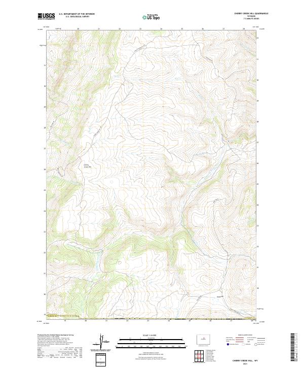
2021 Map of Cherry Creek Hill
USGS Topo · Published 2021About this map
Middle Fork Powder River carves a winding path through this corner of the high plains, where the Washakie Co Natrona Co line marks the southern boundary of this topographic study. The landscape is defined by the prominent Cherry Creek Hill and the relatively level expanse of Kidd Flat to the southeast. A network of primitive roads and drainage systems, including Rock Cr and Bar C Cr, suggests a region largely dedicated to open-range livestock grazing and resource management.
Find a feature on this map
21 named features on this map. Tap any name to fly to it.
Don’t see what you’re looking for? This feature index may not catch every label — zoom into the map to look around manually.
Map Details
Editions of this 2021 Cherry Creek Hill Map
This is the sole edition of this map. No revisions or reprints were ever made.
Other maps of this area

1952 · Grave Spring
USGS Topo · 1:24,000

1952 · Badwater NE
USGS Topo · 1:24,000

1955 · Arminto
USGS Topo · 1:250,000

1958 · Arminto
USGS Topo · 1:250,000

1962 · Arminto
USGS Topo · 1:250,000

1967 · Mahogany Butte
USGS Topo · 1:24,000

1967 · Horse Butte
USGS Topo · 1:24,000

1967 · Gordon Creek
USGS Topo · 1:24,000

1967 · Turk Springs
USGS Topo · 1:24,000
1967 · Cherry Creek Hill
USGS Topo · 1:24,000