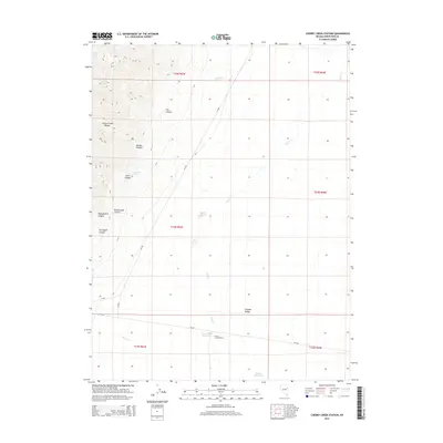
2014 Map of Cherry Creek Station
USGS Topo · Published 2014About this map
Cherry Creek Station serves as the focal point of this high-desert landscape in White Pine County, where the desert floor of the Steptoe Valley meets the rising slopes of the Cherry Creek Range. The map reveals a series of prominent drainages cutting through the mountains, including Exchequer Canyon, Montgomery Canyon, and Rattlesnake Canyon. These geological features point to the region's historic mining and ranching character, supported by vital water sources like Cherry Creek Hot Springs and Steptoe Waterhole. Modern infrastructure is represented by the path of NV-489 and county routes like CR-785, which navigate the wide-open spaces between the range and the persistent flow of Duck Cr. This 2014 survey documents the enduring settlement patterns and essential water locations required for life in the Great Basin.
Find a feature on this map
25 named features on this map. Tap any name to fly to it.
Don’t see what you’re looking for? This feature index may not catch every label — zoom into the map to look around manually.
Map Details
Editions of this 2014 Cherry Creek Station Map
This is the sole edition of this map. No revisions or reprints were ever made.
Other maps of this area

1955 · Elko
USGS Topo · 1:250,000

1956 · Ely
USGS Topo · 1:250,000

1958 · Elko
USGS Topo · 1:250,000

1959 · Ely
USGS Topo · 1:250,000

1962 · Elko
USGS Topo · 1:250,000

1963 · Ely
USGS Topo · 1:250,000

1965 · Elko
USGS Topo · 1:250,000

1982 · Borchert Spring
USGS Topo · 1:24,000

1982 · Exchequer Spring
USGS Topo · 1:24,000

1982 · Cherry Spring
USGS Topo · 1:24,000