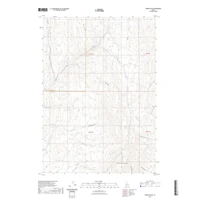
2023 Map of Cherry Gulch
USGS Topo · Published 2023About this map
Willow Ridge and the surrounding drainage basins define this portion of Southwest Idaho along the border of Payette and Gem counties. The landscape is dominated by a complex network of seasonal and perennial waterways, most notably Big Willow Creek and its many tributaries like Fourmile Creek and Lakes Creek. The terrain is marked by deep canyons and gulches, including the namesake Cherry Gulch, Cold Spring Canyon, and Dyes Gulch. A significant cultural landmark is identified as Sehewoki'i Newenee'an Katete near the southern boundary. While the area is largely characterized by its natural topography, the infrastructure of the early 21st century is represented by Four Mile Road and Big Flat Road, which provide access through the Big Flat area. Water sources such as Lower Corral Creek Spring suggest the vital role of natural hydrology in this arid environment.
Find a feature on this map
25 named features on this map. Tap any name to fly to it.
Don’t see what you’re looking for? This feature index may not catch every label — zoom into the map to look around manually.
Map Details
Editions of this 2023 Cherry Gulch Map
This is the sole edition of this map. No revisions or reprints were ever made.
Other maps of this area

1892 · Boise
USGS Topo · 1:125,000

1894 · Squaw Creek
USGS Topo · 1:125,000

1897 · Boise
USGS Topo · 1:125,000

1897 · Weiser
USGS Topo · 1:125,000

1898 · Nampa
USGS Topo · 1:125,000

1953 · Montour
USGS Topo · 1:62,500

1955 · Baker
USGS Topo · 1:250,000

1955 · Boise
USGS Topo · 1:250,000

1958 · Boise
USGS Topo · 1:250,000

1959 · Baker
USGS Topo · 1:250,000