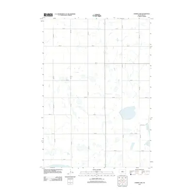
2012 Map of Cherry Lake
USGS Topo · Published 2012About this map
Plum Lake and the northern reaches of Spirit Lake dominate the hydrology of this Kingsbury County landscape, where glacial depressions form numerous unnamed wetlands across the prairie. The 2012 geography is defined by a rigid section-line road network, including thoroughfares like 430th Ave and 434th Ave, which partition the territory into large agricultural tracts. This pattern of land use reflects the enduring structure of the township system in South Dakota, where rural infrastructure is primarily oriented around moving commodities to regional hubs. Smaller access points like Plum Lake Rd and Ash St provide localized access to the lakefronts, illustrating how the natural topography of the water bodies slightly disrupts the otherwise perfectly linear grid of the eastern plains.
Find a feature on this map
19 named features on this map. Tap any name to fly to it.
Don’t see what you’re looking for? This feature index may not catch every label — zoom into the map to look around manually.
Map Details
Editions of this 2012 Cherry Lake Map
This is the sole edition of this map. No revisions or reprints were ever made.
Other maps of this area

1899 · De Smet
USGS Topo · 1:125,000

1953 · Watertown
USGS Topo · 1:250,000

1958 · Watertown
USGS Topo · 1:250,000

1968 · Erwin
USGS Topo · 1:24,000

1971 · Bancroft East
USGS Topo · 1:24,000

1971 · De Smet
USGS Topo · 1:24,000

1973 · Willow Lake
USGS Topo · 1:24,000

1973 · Bryant
USGS Topo · 1:24,000

1973 · Vienna West
USGS Topo · 1:24,000
1973 · Cherry Lake
USGS Topo · 1:24,000