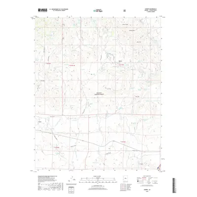
2018 Map of Cherry
USGS Topo · Published 2018About this map
Cherry and Hecla occupy a high-elevation landscape within the Prescott National Forest, where the eastern slopes of the Black Hills descend toward Cherry Creek. This high-desert terrain is defined by a complex network of springs and canyons, including Wilbur Canyon and Tex Canyon. The historical footprint of mining and transit is evident in the naming of Federal Mine Rd and the significant corridor of General Crook, which traverses the southern portion of the map. These roads follow the natural contours of the land, connecting scattered water sources like Lamb Tanks and Hanks Tank. Prominent peaks such as Crater Mtn and Onion Mtn provide visual landmarks in an area dominated by deep washes like Buckbed Wash and Hackberry Wash. The map documents a rugged interior of Arizona where 19th-century military and mining routes established the foundational infrastructure for the modern forest roads.
Find a feature on this map
78 named features on this map. Tap any name to fly to it.
Don’t see what you’re looking for? This feature index may not catch every label — zoom into the map to look around manually.
Map Details
Editions of this 2018 Cherry Map
This is the sole edition of this map. No revisions or reprints were ever made.
Other maps of this area

1887 · Verde
USGS Topo · 1:250,000

1887 · Prescott
USGS Topo · 1:250,000

1892 · Verde
USGS Topo · 1:250,000

1892 · Prescott
USGS Topo · 1:250,000

1903 · Bradshaw Mountains
USGS Topo · 1:125,000

1905 · Jerome
USGS Topo · 1:125,000

1923 · Camp Verde
USGS Topo · 1:125,000

1929 · Turret Peak
USGS Topo · 1:125,000

1932 · Camp Verde
USGS Topo · 1:125,000

1933 · Turret Peak
USGS Topo · 1:125,000