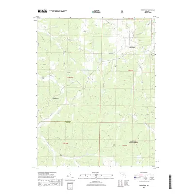
2017 Map of Cherryville
USGS Topo · Published 2017About this map
Cherryville and the small settlement of Limberlost anchor this section of the Ozark Plateau, where the landscape transitions into the protected woods of the Mark Twain National Forest. The map reveals a deeply etched topography of ridges and hollows, such as Bates Hollow and Dry Hollow, which dictate the winding paths of rural routes like Rebel Ridge Rd and State Hwy TT. For those tracing local family histories, several burial sites are documented throughout the township lines, including New Home Cem, Freeman Cem, and Wilkinson Cem. The drainage patterns are dominated by the winding course of Crooked Creek and Dry Cr, while man-made landmarks like Hubbman Lake and Geize Lake appear as localized focal points in the terrain near the Crawford and Dent County line.
Find a feature on this map
54 named features on this map. Tap any name to fly to it.
Don’t see what you’re looking for? This feature index may not catch every label — zoom into the map to look around manually.
Map Details
Editions of this 2017 Cherryville Map
This is the sole edition of this map. No revisions or reprints were ever made.
Other maps of this area

1932 · Steelville
USGS Topo · 1:48,000

1933 · Steelville
USGS Topo · 1:62,500

1937 · Steelville
USGS Topo · 1:62,500

1941 · Stone Hill
USGS Topo · 1:62,500

1943 · Berryman
USGS Topo · 1:62,500

1943 · Boss
USGS Topo · 1:62,500

1945 · Stone Hill
USGS Topo · 1:62,500

1945 · Berryman
USGS Topo · 1:62,500

1946 · Boss
USGS Topo · 1:62,500

1949 · Rolla
USGS Topo · 1:250,000