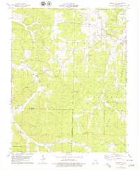
1978 Map of Cherryville
USGS Topo · Published 1979About this map
Cherryville and the winding waters of Courtois Creek anchor this late 1970s landscape in the Ozarks. The area is defined by its deep history of resource extraction, evidenced by numerous Iron Pits and a Claypit scattered through the hills, many of which are now preserved within the Mark Twain National Forest. A notable remnant of earlier transit and industry is the St Louis San Francisco railroad corridor, alongside sections of Old Railroad Grade that snake through Short Bend and the southern forest. Family legacy is clearly marked across the terrain by several small burial grounds, including the Wilkinson Cem and Earney Cem. The map provides a detailed view of the transition between developed settlements like Limberlost and the managed timberlands of the Indian Trail State Forest.
Find a feature on this map
35 named features on this map. Tap any name to fly to it.
Don’t see what you’re looking for? This feature index may not catch every label — zoom into the map to look around manually.
Map Details
Editions of this 1978 Cherryville Map
This is the sole edition of this map. No revisions or reprints were ever made.
Other maps of this area

1932 · Steelville
USGS Topo · 1:48,000

1933 · Steelville
USGS Topo · 1:62,500

1937 · Steelville
USGS Topo · 1:62,500

1941 · Stone Hill
USGS Topo · 1:62,500

1943 · Berryman
USGS Topo · 1:62,500

1943 · Boss
USGS Topo · 1:62,500

1945 · Stone Hill
USGS Topo · 1:62,500

1945 · Berryman
USGS Topo · 1:62,500

1946 · Boss
USGS Topo · 1:62,500

1949 · Rolla
USGS Topo · 1:250,000