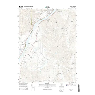
2013 Map of Cheshire
USGS Topo · Published 2013About this map
The Ohio River carves a deep valley through the borderlands of Ohio and West Virginia, anchoring a chain of riverfront settlements including Middleport, Cheshire, and West Columbia. This stretch of the river is defined by heavy industrial and transportation infrastructure, most notably the extensive Hobson Yards and the strategic Hobson Junction. These rail facilities, situated on the northern bank, highlight the era's reliance on coal and freight transport along the river corridor.
Find a feature on this map
101 named features on this map. Tap any name to fly to it.
Don’t see what you’re looking for? This feature index may not catch every label — zoom into the map to look around manually.
Map Details
Editions of this 2013 Cheshire Map
This is the sole edition of this map. No revisions or reprints were ever made.
Other maps of this area

1907 · Pomeroy
USGS Topo · 1:62,500

1907 · Keno
USGS Topo · 1:62,500

1908 · Ravenswood
USGS Topo · 1:62,500

1908 · Point Pleasant
USGS Topo · 1:62,500

1926 · Ravenswood
USGS Topo · 1:62,500

1926 · Point Pleasant
USGS Topo · 1:62,500

1928 · Ravenswood
USGS Topo · 1:62,500

1929 · Point Pleasant
USGS Topo · 1:62,500

1947 · Columbus
USGS Topo · 1:250,000

1949 · Clarksburg
USGS Topo · 1:250,000