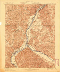
1929 Map of Point Pleasant
USGS Topo · Published 1929About this map
The confluence of the Ohio River and the Kanawha River anchors this 1929 survey of the borderlands between West Virginia and Ohio. This river-centered economy is visible through the concentration of industry and transport at Point Pleasant and Gallipolis, while the surrounding hills are dotted with a dense network of local institutions. The map reveals the critical role of river navigation and rail transport in the late 1920s, featuring the Hocking Valley, Baltimore and Ohio, and New York Central railroads as they parallel the major waterways.
Find a feature on this map
85 named features on this map. Tap any name to fly to it.
Don’t see what you’re looking for? This feature index may not catch every label — zoom into the map to look around manually.
Map Details
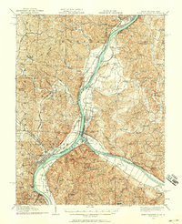
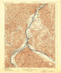
Editions of this 1929 Point Pleasant Map
2 editions found
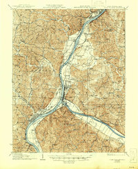
Historical Maps of Point Pleasant Through Time
3 maps found