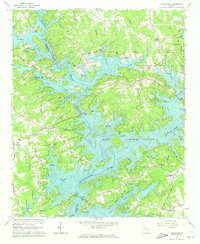
1964 Map of Chestatee
USGS Topo · Published 1973About this map
Lake Sidney Lanier dominates this mid-1960s landscape, where the rising waters of the reservoir have transformed the confluence of the Chattahoochee River and Chestatee River into a complex system of inlets and bays. The map documents a pivotal era of recreational development, evidenced by numerous public access points like Duckett Mill Access Point and Nix Bridge Access Point, alongside established facilities such as the Gainesville Marina.
Find a feature on this map
67 named features on this map. Tap any name to fly to it.
Don’t see what you’re looking for? This feature index may not catch every label — zoom into the map to look around manually.
Map Details
Editions of this 1964 Chestatee Map
3 editions found
Other maps of this area

1890 · Suwanee
USGS Topo · 1:125,000

1891 · Gainesville
USGS Topo · 1:125,000

1894 · Suwanee
USGS Topo · 1:125,000

1954 · Greenville
USGS Topo · 1:250,000

1955 · Rome
USGS Topo · 1:250,000

1958 · Greenville
USGS Topo · 1:250,000

1958 · Rome
USGS Topo · 1:250,000

1961 · Rome
USGS Topo · 1:250,000

1963 · Rome
USGS Topo · 1:250,000

1964 · Murrayville
USGS Topo · 1:24,000