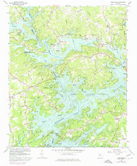
1964 Map of Chestatee
USGS Topo · Published 1974About this map
Lake Sidney Lanier dominates this North Georgia landscape, where the rising waters of the reservoir have transformed the confluence of the Chattahoochee River and Chestatee River. The map documents a transitional period of development, showing the proliferation of public access points like the Davis Bridge Access Point and Nix Bridge Access Point alongside established rural communities. Cultural landmarks such as Bethel Tabernacle Cem, Sardis Sch, and McEver Sch provide essential touchpoints for genealogists tracing family roots in Hall, Forsyth, and Dawson counties. The intricate shoreline of Chestatee Bay and the numerous named creeks, including Thompson Creek and Flat Creek, illustrate the complex topography that defines the region. While the corporate limits of Gainesville appear in the northeast, much of the area retains a rural character defined by local road networks like Keith Rd and Martin Rd.
Find a feature on this map
61 named features on this map. Tap any name to fly to it.
Don’t see what you’re looking for? This feature index may not catch every label — zoom into the map to look around manually.
Map Details
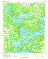
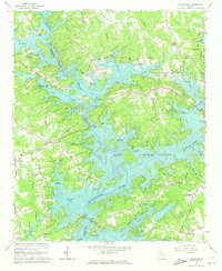
Editions of this 1964 Chestatee Map
3 editions found
Other maps of this area

1890 · Suwanee
USGS Topo · 1:125,000

1891 · Gainesville
USGS Topo · 1:125,000

1894 · Suwanee
USGS Topo · 1:125,000

1954 · Greenville
USGS Topo · 1:250,000

1955 · Rome
USGS Topo · 1:250,000

1958 · Greenville
USGS Topo · 1:250,000

1958 · Rome
USGS Topo · 1:250,000

1961 · Rome
USGS Topo · 1:250,000

1963 · Rome
USGS Topo · 1:250,000

1964 · Murrayville
USGS Topo · 1:24,000