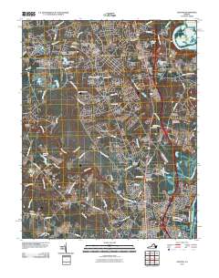
2010 Map of Chester
USGS Topo · Published 2010About this map
Chester serves as the focal point of this 2010 survey, showcasing a landscape of suburban expansion south of Richmond. The residential character of the region is defined by numerous developments such as Lora Lynn Heights, Mistwood Forest, and Windsor Hills, which surround the primary commercial and transportation corridor of Interstate 95. Significant historical and genealogical markers are scattered throughout the quadrangle, including the Perdue Family Cemetery and Hollywood Cemetery. Along the eastern edge, the industrial and nautical history of the region is evident where Redwater Creek flows toward the James River (Old Channel) and the distinctive terrain of Farrar Island at Dutch Gap. To the south, the community of Colonial Heights begins to emerge near the Appomattox River, while local landmarks like the Swift Creek Mill reflect the area's long-standing connection to its waterways.
Find a feature on this map
108 named features on this map. Tap any name to fly to it.
Don’t see what you’re looking for? This feature index may not catch every label — zoom into the map to look around manually.
Map Details
Editions of this 2010 Chester Map
This is the sole edition of this map. No revisions or reprints were ever made.
Other maps of this area

1894 · Bermuda Hundred
USGS Topo · 1:62,500

1894 · Petersburg
USGS Topo · 1:62,500

1897 · Amelia
USGS Topo · 1:125,000

1938 · Dutch Gap
USGS Topo · 1:24,000

1938 · Drewrys Bluff
USGS Topo · 1:24,000

1943 · Dutch Gap
USGS Topo · 1:31,680

1943 · Chesterfield
USGS Topo · 1:31,680

1943 · Hopewell
USGS Topo · 1:31,680

1943 · Beach
USGS Topo · 1:24,000

1943 · Sutherland
USGS Topo · 1:24,000