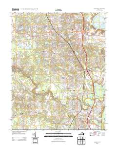
2013 Map of Chester
USGS Topo · Published 2013About this map
Pickadat Corner and the surrounding residential developments characterize this suburban landscape south of Richmond in the early 21st century. The area is defined by a dense network of neighborhoods including Chesterbrook Farms, Mistwood Forest, and Shadowbrook Heights, reflecting the continued expansion of the Tri-Cities region. Local water features like Chester Club Lake and Redwater Lake are integrated into these communities, while the James River Old Channel and the Old North Channel near Archer Bluff serve as reminders of the river's historical path. Significant transit corridors such as Jefferson Davis Hwy and the Walthall Industrial Pkwy connect these residential pockets to regional industrial centers like Walthall and Dunlop, illustrating a modern economy built on the intersection of logistics and suburban growth.
Find a feature on this map
89 named features on this map. Tap any name to fly to it.
Don’t see what you’re looking for? This feature index may not catch every label — zoom into the map to look around manually.
Map Details
Editions of this 2013 Chester Map
This is the sole edition of this map. No revisions or reprints were ever made.
Other maps of this area

1894 · Bermuda Hundred
USGS Topo · 1:62,500

1894 · Petersburg
USGS Topo · 1:62,500

1897 · Amelia
USGS Topo · 1:125,000

1938 · Dutch Gap
USGS Topo · 1:24,000

1938 · Drewrys Bluff
USGS Topo · 1:24,000

1943 · Dutch Gap
USGS Topo · 1:31,680

1943 · Chesterfield
USGS Topo · 1:31,680

1943 · Hopewell
USGS Topo · 1:31,680

1943 · Beach
USGS Topo · 1:24,000

1943 · Sutherland
USGS Topo · 1:24,000